Future Landscape Trust, An Environmental Design Project in Sussex
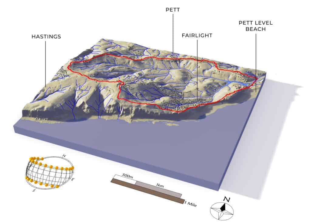
The Future Landscapes Trust has initiated the Future Trust project, an ambitious effort to mitigate flooding in the coastal village of Pett Level, East Sussex. Covering a land area of 797 hectares, delimited by a watershed situated in the county of East Sussex in the South of England, the project aims to address the increasing frequency and severity of floods affecting the village, which has seen several devastating floods in recent years. A watershed, also known as a drainage basin or catchment area, is an area of land where all precipitation drains or flows into a common outlet.
In response to the increasing threat of flooding, intensified by potential fluctuations in climate patterns, a proactive initiative has been launched by The Future Landscapes Trust team and Green Curves. Together, they are dedicated to strengthening flood resilience across the affected watershed by employing natural, regenerative solutions. These nature-based strategies are designed not only to reduce flood risk but also to provide significant environmental, societal, and ecological benefits to all residents and businesses within the watershed.
The project focuses on holding water in the valley sides during peak rainfall and releasing it slowly to lower flood levels. Strategies include improving ground cover to enhance the water absorption capacity of woodlands and grasslands, and constructing mini “leaky dams” to hold back water during torrential rains.
Green Curves is carrying out a detailed topographic survey of the land followed by a thorough analysis of floods in the affected basin. This groundbreaking project underlines their dedication to regenerative land management and to help ensure better protection for all communities and individuals affected by the problem.
The Future Landscapes Trust is dedicated to incorporating the community’s input and is working with a diverse group of partners, including the Marsham Brook Lane Residents Association, the RSPCA, local parish councils, High Weald National Landscape, the South East Rivers Trust, Southern Water, and the Environment Agency.
Software Application
Key components of the project include nature-based solutions, community engagement, advanced design tools, and partnerships. Leveraging technologies like QGIS, Rhino, Grasshopper, Ladybug, Lands Design, and Photoshop, the project models, analyzes, and visualizes design interventions. The design work for this project has been expertly carried out by Landplanner and Green Curves Design.
The brief includes creating 3D map visuals of the watershed landform, including waterline indications to help explain the concept of drainage basins. This model was created remotely, utilizing high-resolution public data topography.
Overall, the Future Trust Project is an example of an environmental design initiative focused on mitigating flooding in a coastal village. It combines cutting-edge design technologies with community-driven approaches to address pressing environmental challenges, aspiring to create a sustainable and resilient environment for Pett Level and setting a precedent for similar initiatives in other vulnerable coastal regions.


